Monday 15 September 2014

Final island, island number 21 -Bute


After a calm wander in and around the Cathedral of the Isles,  the smallest cathedral in Britain (doesn't this make Millport a city?), we left Cumbrae and headed back to Largs on the ferry.  Then came the hardest part of this trip, the six miles along the coast road to Wemyss Bay. We survived that scary trip and crossed over to Rothesay on the Isle of Bute.

Tired out from yesterday's 38 miles, we pottered north to Port Bannatyne,  looked for my friend's boat, 'Jumblie'. Not there so he must be sailing, which is a lovely thought. We've had grand times in these waters and I look forward to more of them next year.

Bikes on the train back to Glasgow - islands all biked!
Last ferry of the project
Back to the island-biking. After a bit of biking along the shore and marvelling at the number and size of the YES signs, we headed back through Millport for a final food stop at the charming 'Pier at Craigmore'. Then we retraced our steps, so to speak, to the ferry with the wind behind us, train home and that's the end of that biking challenge. Bring on the next one!

Sunday 14 September 2014

Island 20 - Cumbrae, 13th September 2014

Taking advantage of this continuing good weather (I chose a great year to bike islands! ), I set off on the train to Largs by way of a 14 mile reccie of a GoSkyride route in Glasgow.  Checked on a 93 year-old friend in Largs, introduced the support team (of one) to the iconic Nardini's and got on the ferry for the very short crossing to the Isle of Cumbrae.
Knickerbocker glories

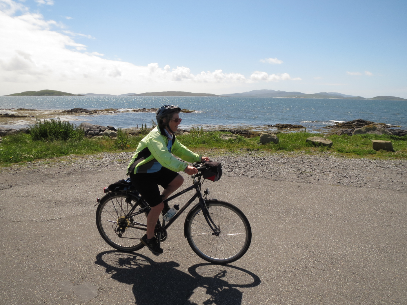
The road around the coast is only 10  miles but it felt longer to support team, Mehrab, as we had already biked 27 miles that day.  In the late afternoon, it was peaceful and beautiful. There were more bicycles on that route than cars, as people enjoyed the unexpected warm sunshine.

There are five posts along the way and the visitor is invited to touch all five in order to be able to take home some of the luck of the islanders. Great idea for getting people to engage with their surroundings.  We duly stopped at each of them and touched them. I have plenty of luck already but good to stock up anyway.

We ate at the Chinese restaurant because everywhere else stopped serving very early. This is different to the Glasgow nightlife that Mehrab is used to.  The restaurant is not licenced but has an arrangement with the pub next door that customers can buy drinks and bring them in.  The restaurant staff return the glasses next day. What a simple and effective solution!


We are travelling in the week before the Referendum.  This is an extraordinary time to be in Scotland.  Public engagement in politics has never been this high.  This is a 'divided house' I was told by one of the occupants. Wow!

The B&B was disappointingly typical of long ago. While being a modern house it was stingy about things, which is so silly. But there is so little accommodation on the island that you can get away with all sorts of second-rate service. It is not on TripAdvisor but I got my 'revenge' by paying with a cheque instead of cash. I'll leave the reader to work that one out.

Saturday 6 September 2014

Island 19 – Bull Island, Co. Dublin, Ireland

We mustn’t leave Ireland out of the island-biking and decided that doing an East coast island was the most practicable. Bull Island is more commonly referred to as the ‘Bull Wall’ because the island grew up in front of the wall. Captain William Bligh of Mutiny on the Bounty proposed the building of the North Bull Wall which was completed in 1825. The other piece of interesting information, which is true in spite of the disbelieving looks with which it was greeted in the Antiquary by Roy and Bill D, is that a mouse (and presumably her family) developed sandy colouring to blend in on the island. Bull Island was one place for the ‘Waxies’Dargle’ – a seaside outing for working class people, including ‘waxies’, candlemakers or those who waxed coats and boots, depending on your source. ‘Says my auld wan to your auld wan, will you come to the waxies’ dargle …’. 

Eilish and Marian did a lot of research (about the ride) and concluded that we had to start in Howth, where we could hire bikes at the Bike Hub. We put the word out to family and friends on Facebook and two of my lovely nieces joined us oldies. Did I mention that I have the loveliest nieces in the world?
Starting with a coffee as usual

The day dawned warm and sunny and we started with a coffee (no change there then) sitting outside at Il Panorama. We made a start on the emergency supplies; it reduced what we had to carry anyway. Bikes were collected and I did my bossy safety checks with helmets and bikes. By now we had agreed roles in the group – we had heads of navigation, catering, social media and photography. Missing Bill Badger as always!  After a few photoshoots, to the great amusement of the bike shop staff, we set off in the traffic. Yes, there are bike lanes on that road, but cars parked in them makes it more dangerous than it needs to be. Travelling in a small group feels so much safer than a solo trip. The path then went off-road and that was really nice.

At the causeway/Bull Wall cyclists were supposed to dismount. Those of you who follow my biking adventures will know that such restrictions have to be ignored if you are ever going to have any fun in life. How many bridges could I have done if I had dismounted at every sign? So we biked across the wooden causeway road, irritating the motorists coming the other way when some of us didn’t quite make it across before the lights changed. After a bit of fun on the wall, photoshoots of each other and of interesting scenes, like the man fishing, we went onto the beach for our picnic. What a lovely area this is! We had a very sandy picnic and shared stories from the 1970s when Marian and I had a flat in Dublin together.


Lovely, less distracted, ride back to Howth where I bought some cycling gloves and Ali bought a bike, as you do! I hope that was a good recompense for the very reasonable rental rate we were charged by the Bike Hub. Then time for afternoon tea/coffee and finishing off the emergency supplies. The raspberry flapjack was probably the food highlight of the day, thanks to Michelle Roche (Head of Catering and Hospitality).

Two more islands to go to meet my target of 21. I am not sure I will make it but maybe. It’s all good fun anyway.


Wednesday 27 August 2014

Bull Island - here we come

A sortie involving Bull Island is planned for Sunday 31st August - watch this space! Causeway and all that, so the main challenge is getting bikes there. Eilish Roche to the rescue!

This will be Island number 19. Some information about it from
http://goireland.about.com/od/parksandgardens/qt/bull_island.htm:


"Bull Island did not exist before the Bull Wall, a breakwater, was built in 1825. This led to sands accumulating between the wall and dry land, which in turn led to Bull Island rising out of the sea. When Darwin was working on his Origin of Species , the Bull Island Mouse was discovered and became chief witness to Darwin's theories - it had evolved from the field and house mice of the vicinity, adapting to island life by changing its coat to a sandy color. No wonder that the island is a UNESCO biosphere these days."

Sunday 6 July 2014

Island 18 - South Uist, 4th July 2014

Welcome signs are very handy to remember where your are

Yes, I did have a busy day on the 4th July but South Uist is only a couple of mines from where the Barra ferry comes in at Eriskay (new) harbour. There is a causeway between the two islands and I am going to use that same pic of the wonderful sign because I love it so much.
Cycling on South Uist with Barra in the background

Speaking of signs, I espied a Green Yes leaflet in the waiting room at the Eriskay Harbour, but on with the journey.

I loved these signs
I did enjoy South Uist. The sun had come out and the wind had eased and I pottered along by the sea, admiring the cottages and the lovely little sandy beaches. I met a young man, Cameron, out doing daring stuff on his bike with his little brother. He was kind enough to take some pictures of me, including this action shot. I was without any support team and so am very grateful to Cameron for stepping in for Bill, who had been Head of Photography until I found Cameron.

Sorry about that, Bill - you shouldn't have left.

So it was time to head back through Eriskay to Barra and from there by big ferry to Oban at the end of my wonderful two-week island-hopping trip. I am indebited to all my supporters along the way - to Mehrab, Willie, Anne, Bill and Cameron as well as to the author of the helpful little book Anne found on Islay - 'Cycling in the Hebrides' by Richard Barrett. Much of the information in these blog posts come from there - like the story of the prize bull drowning on the Vatersay crossing.


Island 17 -Eriskay, 4th July 2014


Sign to Eriskay on Barra
On the ferry to Eriskay
The ferry to Eriskay is only 8 miles from Castlebay on Barra - eight fairly hilly miles but I didn't have my panniers. That was lucky as they now contain a range of distillery tee-shirts, a party frock and shoes and a ceramic image of Skerryvore lighthouse, bought at Tyrii Pottery. They are not as light as they were - pardon the pun.


It's quite amazing to me how close and yet distinct each of these Hebridean islands are. They would not be so close in very bad weather although the causeways from Eriskay to the north have made travel between the islands very much easier. It might be hard on the otters trying to cross the road though - I do love that sign.
I sat by the causeway trying to see otters but it was the wrong time of day.

Eriskay has a shop (something for which we must always be grateful) and a café in the Community Hall. Like other
community cafés, it was hospitable and comfortable. Eriskay also has a pub, romantically entitled 'Am Politician' after the ship which sank with all that whisky in 1941. It is a very unprepossessing place but the food was nice and the view is Hebridean - i.e. fabulous.

The weather has brightened up considerably and I had an easy two mile ride to the causeway for Island 18, South Uist, keeping a careful eye out for otters crossing!

Thursday 3 July 2014

Island 16 -Vatersay, 3rd July 2014


 On Vatersay,  looking at breakers in the sea.
Looking down to the Vatersay causeway
Vatersay is the southern-most inhabited island in the Outer Hebrides. It is attached to Barra by a causeway. This was built, so the story goes, after a prize bull, called Bernie, drowned while swimming the short channel in 1986.
Check out the cover on the slot for letters. 
Rain and wind made photography difficult

I cycled there from Castlebay on Barra. It is just about 2 miles but the weather conditions were pretty severe. I decided that it wouldn't be wise to explore very far as the visibility was poor and I was without my intrepid support team. It would be a wonderful place to explore on bike in better weather conditions.  Memo to self: come back here for a couple of weeks next year and have a play along all the Outer Hebrides.